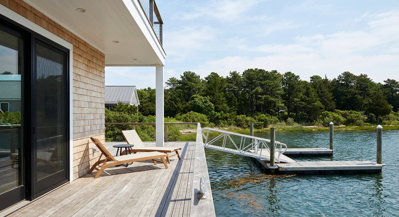
Imagine stepping from your deck onto a dock at sunrise or strolling a few minutes to the surf before dinner. If you are weighing a first or second home in Ocean County, the choice between barrier‑island beaches, quiet bayfront lagoons, and marina hubs can feel complex. In this guide, you will learn how the shore communities differ, how boating access and beaches work, what to know about flood insurance and long‑term risk, and the key steps to vet any waterfront home. Let’s dive in.
Ocean County waterfront at a glance
Ocean County covers a wide mix of waterfront settings on the Atlantic barrier peninsula and along protected bays, tidal rivers, and canals. For context, review the county’s official list of shore municipalities to see how the barrier‑island boroughs and bay towns line up along the coast. You can browse that overview on the county site in the section that lists its coastal communities (Ocean County municipal list).
This coastline creates three distinct experiences:
- Oceanfront barrier islands on the Barnegat Peninsula and Long Beach Island with surf beaches and boardwalks in select towns (Barnegat Peninsula overview).
- Bayfront, canals, and lagoons along Barnegat Bay and Little Egg Harbor with practical boating access and calmer water.
- Tidal rivers and inlet corridors with marinas, yacht clubs, and public launches that connect to the bay and ocean.
Communities and property styles
Long Beach Island and barrier‑peninsula towns
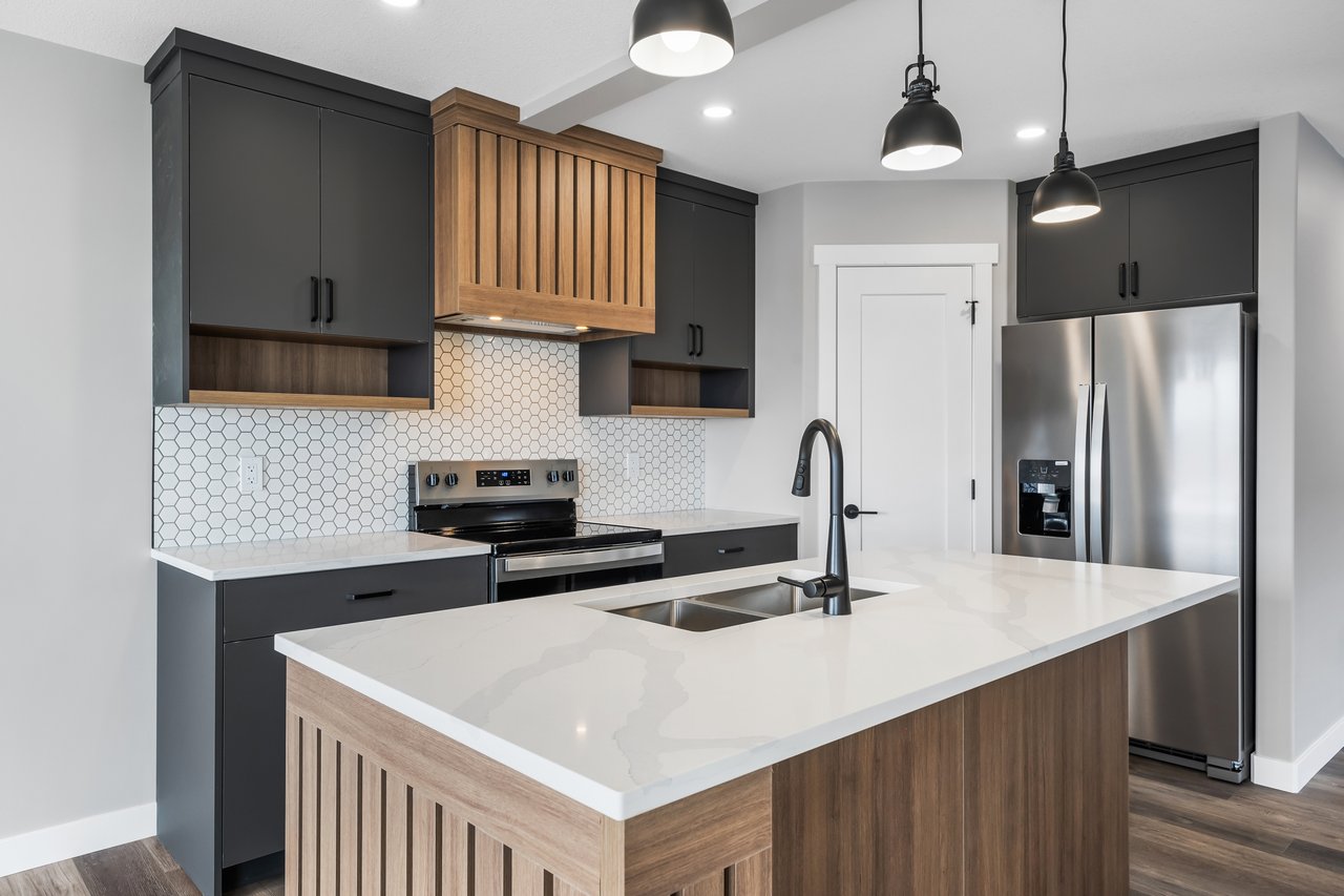
On Long Beach Island and the Barnegat Peninsula, you will find a mix of classic shingle cottages, elevated shore homes on pilings, and larger new construction aimed at second‑home buyers. Some sections skew livelier in summer near commercial areas and boardwalks, while other pockets read as quieter residential blocks. The result is a spectrum from beach‑and‑boardwalk energy to low‑key oceanfront living (Barnegat Peninsula overview).
Bay Head and Mantoloking
Bay Head and Mantoloking are small, architecturally notable shore towns with a concentration of higher‑end properties. Many homes here have been raised or rebuilt to modern coastal standards. Ocean or bay frontage lots are limited, which supports premium values. Expect a refined residential feel with beach and bay access close at hand.
Canals, lagoons, and bayfront enclaves
Neighborhoods in Forked River, parts of Toms River and Brick, Bayville, and Mystic Islands in Little Egg Harbor offer direct boating convenience. Many lots include bulkheads and private docks, and canals vary in width, depth, and travel time to open water. Homes range from modest year‑round ranches and bungalows to expanded waterfront houses that emphasize outdoor living and dockage.
Boardwalk and resort hubs
Seaside Heights, Seaside Park, and Point Pleasant Beach are classic boardwalk towns with a strong seasonal rhythm. You will see more small condos and cottage clusters, short‑term rental activity, and summertime service patterns. That resort profile is distinct from the quieter bay and lagoon neighborhoods nearby (Jersey Shore overview).
Marinas, launches, and boating logistics
Barnegat Bay and Little Egg Harbor host numerous marinas, yacht clubs, public launches, and municipal mooring fields. The region emphasizes responsible boating, including pump‑out services and a NO‑DISCHARGE zone for the bay. Before you buy, review boat services and local rules for the locations you will actually use (boating on Barnegat Bay).
What to check early:
- Slip or mooring availability, waitlists, and seasonal fees. Towns publish policies, schedules, and eligibility. For example, Lavallette outlines resident mooring and ramp rules, which shows how many shore towns handle access and permits (Lavallette moorings and ramps).
- Fuel, pump‑out, travel lift, winter storage, and depth at dead‑low tide at your preferred marina.
- Bridge clearances and channel depths along your route to Barnegat Inlet or the ocean.
- Bulkhead and dock condition on the property, plus dredging or channel maintenance plans nearby.
Slip pricing and availability vary by season and marina. Ask for current rate sheets rather than relying on older ranges.
Beaches, seasons, and daily rhythm
Ocean County’s barrier‑island beaches draw day‑trippers and seasonal visitors, while bay beaches and neighborhood bayside parks stay calmer. Boardwalk towns see peak crowds in warm months and a quieter off‑season. Seasonal badge rules, parking policies, and lifeguard coverage vary by town. If easy ocean access is your priority, focus on neighborhoods that place you near guarded beaches and walkable amenities. For a slower pace, consider bayfront and lagoon communities where boating and sunsets take center stage (Jersey Shore overview).
Flood zones, insurance, and long‑term risk
Coastal living comes with extra due diligence. A few concepts matter for both safety and financing:
- Flood zones and BFE. FEMA maps identify Special Flood Hazard Areas, including A or AE zones and coastal V or VE zones. The Base Flood Elevation is the reference point for building and insurance rating. Lenders use these designations to determine when flood insurance is required for federally backed loans (FEMA flood terminology).
- Letters of Map Change. Some owners obtain a Letter of Map Amendment or Revision and an elevation certificate to clarify a property’s risk or to reflect elevation improvements. You can review how property‑level map changes work through FEMA’s Online LOMC guidance (FEMA LOMC guidance).
- Risk Rating 2.0. FEMA’s updated pricing approach changed how NFIP premiums are calculated. Many coastal policies in counties like Ocean County are affected. Some owners see increases while others see decreases, based on elevation and location. Always request a quote for the specific house, not just the zone label (overview of NJ changes).
- Sea‑level rise and storm surge. USGS mapping shows how moderate and major coastal flooding events may inundate parts of the Jersey Shore and Barnegat Bay communities over time. Marshes and wetlands help buffer surge and reduce losses, which matters for community resilience and planning (USGS coastal flood study).
Practical takeaways:
- Ask for the elevation certificate, confirm the FEMA zone, and compare at least two flood quotes.
- Budget for higher wind or hurricane endorsements where required by your carrier.
- Verify local building rules, including elevation and freeboard standards, with the municipality before planning renovations.
Costs and market signals
Waterfront homes typically carry a premium that depends on water type and access. Oceanfront and direct bayfront lots with sandy beach or dockage are scarce and often sit above broader county medians. Canal and lagoon homes trade on convenience to open water and condition of bulkheads and docks. On the expense side, plan for flood insurance, shoreline maintenance, marina or HOA fees, and potentially higher property taxes than similar inland homes.
Market conditions shift by town and season. For the clearest picture, compare recent closed comps within the same water type, lot orientation, and elevation improvements. Usable access, navigable depth, and walkability to beaches or services often move value more than broad averages.
Buyer checklist for Ocean County waterfront
Use this due‑diligence list as you review properties and draft offers:
- Confirm the FEMA flood zone and Base Flood Elevation for the address. Ask the seller for the elevation certificate and any Letters of Map Change. You can reference FEMA’s guidance on property‑level map changes (FEMA LOMC guidance).
- Get at least two written flood insurance quotes, including an NFIP option, and ask how Risk Rating 2.0 affects premiums for the home’s elevation and location (overview of NJ changes).
- If a private dock or slip is advertised, request documents that show ownership or lease terms, association rules, renewal timelines, and seasonal policies. Municipal sites often post mooring rules and waitlists, as Lavallette does for example (Lavallette moorings and ramps).
- Verify utilities and sanitation. Confirm municipal sewer vs. septic and any seasonal service limits with the town.
- Ask the municipality about bulkhead ownership, maintenance responsibility, dune walkovers, and shore‑protection projects that affect the block or lot.
- For boaters, confirm channel depths, bridge clearances, pump‑out availability, and winter storage options. Barnegat Bay is a NO‑DISCHARGE zone that emphasizes responsible boating (boating on Barnegat Bay).
- Budget for shoreline maintenance, insurance impacts for elevated foundations, and any marina or HOA fees. Review FEMA flood terminology so you understand your policy and ratings (FEMA flood terminology).
- If New York City access matters, note that the North Jersey Coast Line terminates at Bay Head, which can simplify trips for some buyers (NJ Transit Bay Head Station).
Choose your fit, then take the next step
Whether you want surf and boardwalk energy, a quiet canal with your boat at the bulkhead, or a bayfront deck for sunset views, Ocean County offers a clear menu of waterfront lifestyles. The smartest path is to align your wish list with the right water type, confirm the elevation and insurance story early, and secure the marina or mooring access you need for boating season.
If you want a data‑driven partner to help you evaluate elevation certificates, line up quotes, and compare true waterfront comps by water type, connect with Jonathan Guzman to Request a Private Strategy Consultation. You will get white‑glove guidance, a clear action plan, and confidence from offer through closing.
FAQs
What are the main types of waterfront areas in Ocean County?
- Oceanfront barrier‑island towns, bayfront and lagoon neighborhoods, and tidal river or inlet corridors with marinas create distinct living experiences (Barnegat Peninsula overview).
How does flood insurance work for Ocean County waterfront homes?
- Lenders use FEMA maps to determine if flood insurance is required, and policies price risk using factors like elevation and location. Learn the basics through FEMA’s glossary (FEMA flood terminology).
What is Risk Rating 2.0 and why does it matter?
- FEMA’s updated pricing method changes how NFIP premiums are calculated. Many coastal properties saw adjustments. Always get home‑specific quotes (overview of NJ changes).
How can I secure a marina slip or municipal mooring near my home?
- Check town sites for rules, fees, and waitlists early. As an example, Lavallette publishes mooring and ramp details, which shows how many towns handle access (Lavallette moorings and ramps).
What should boaters know about Barnegat Bay rules and services?
- The bay is a NO‑DISCHARGE zone with pump‑out services and clean‑boating guidance. Review best practices before the season starts (boating on Barnegat Bay).
How does sea‑level rise affect long‑term waterfront ownership?
- USGS modeling shows increased exposure from sea‑level rise and storm surge over time, which informs elevation choices and community planning (USGS coastal flood study).
What commuter options link Ocean County shore towns to NYC?
- NJ Transit’s North Jersey Coast Line runs to Bay Head, providing a rail connection that many second‑home owners and commuters value (NJ Transit Bay Head Station).